Columnists
The oldest road

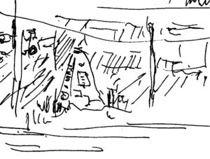
There is but a moment of stillness that holds here: a gap in the intervals when the traffic light stalls vehicle flow on Loyalist Parkway. The corner I am standing on is less than unvarnished. It’s an intersection of rough and tumble sans grace, perhaps more striking on a day like today, as I take it in from a pedestrian’s point of view.
There is a menu of ironies to this site that soaks in history. Over there, dumpsters for rent inhabit a barren lot. Across on the north side is a highway take-out, laced in a carnival of signage. Kitty-corner to that is a ball-field surrounding the Carrying Place post office.
I am in a border land: a place where many stakeholders stand shoulder-to-shoulder while, at the same time, leaving the impression of a no-man’s land. Here, the municipalities of Quinte West and Prince Edward County merge around a small plot owned by the Federal government and managed by Parks Canada.
It was at this spot, in 1929, that a gathering of officials and bystanders witnessed the unveiling of the pyramid- shaped, granite stone marker that stands before me. It’s about the height of a small modern van. Forged to the side of the cairn, a recognizable National Historic Sites burgundy and bronze marker describes the negotiation of a treaty in 1787 between the then-British government based in York— now Toronto—and the Mississauga people.
 The time of the treaty declaration was also a time of a land grab, a time of refugees, people exiting the newly formed independent American Colonies to the south. The refugees were from all bloodlines: German, Iroquoian; Mohawk; British; French among them. Ironically, some of the returning French were Acadians, families that, thirty years earlier, had been expelled from their lands in Nova Scotia, expelled to the Thirteen Colonies to the south by the British. Acadia had been a place of recognized Neutral French: people who simply wanted to build new lives on the eastern seaboard of North America, independent of any allegiance to one country during the British-France hostilities of the Seven Year’s War. Many within the exodus found their way to the New France territory of Louisiana to evolve as the Cajun culture of today.
The historic plaque in my midst goes on to describe what is considered to be the oldest road in continuous use in Ontario—the Kente Portage Road—the crossing place over an isthmus of land that separates the Bay of Quinte from the main body of Lake Ontario. Along the road today, there are but few reminders of anything historical, save for a few buildings once belonging to early newcomers—the Wellers, the Wilkins, the Biggars. There is little else to tell a stranger that something happened here.
Save for the interests that motivated the construction of the cairn three-quarters of a century ago, it seems that few have carried the torch. In our instamatic time of communication, it reflects a measure of caring that a significant place like this can be left neglected. Not only does the site mark five thousand years of use as a trade route and main travel-way of early peoples, it marks the story of a developing nation; the unfolding of a village that once blossomed around an influx of later arrivals during the building of the Murray Canal. Today, it is both the western gateway to the County and, if heading north, an approach to the Quinte region. An opportunity awaits to offer arrivals of today a more inviting welcome.
Comments (0)